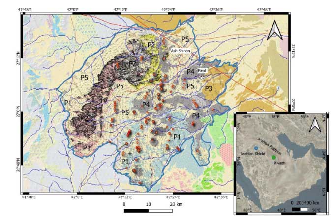
About Salma Geopark

Explore

Salma GEOPARK

Salma Geopark is located 80 km southeast of Hail and 112 km north of Breda, covering an area of 3,145 km². The Salma Mountains, a major tourist attraction in Hail, spread over more than 60 km². The highest peak reaches 1,380 meters above sea level. Key sites within the park include the medieval city of Faid and the historic Darb Zubaydah route. The area is also dotted with water sources, farms, and volcanic craters, making it a fascinating destination for visitors. The park stretches from north to south and east to west, covering a wide area between the coordinates 27° 05'17' N and 42° 18'26'E.

How tall is

Salma Mountain?

The height of Salma Mountain is 1,380 meters, making it four times taller than the French Eiffel Tower and almost a third of Jabal Al-Sawda's height (Saudi Arabia's highest mountain peak). The geological tapestry woven within Salma Geopark is nothing short of extraordinary. At the heart of this captivating landscape lies the iconic Salma Mountain, a treasure trove of over 30 distinct geological formations. These rocky outcrops, each possessing a unique shape and composition, contribute to the rich mosaic that defines this geological wonderland.

Geological stages of

Salma Unesco GEOPARK

The geological map provides a comprehensive overview to identify heritage precincts within the boundaries of the aspiring Salma UNESCO Global Geopark.

  • The light blue and deep blue regions correspond to the ancient rocks of the Arabian Shield and are primarily linked to Precinct 1.
  • The pink region, associated with batholiths, dates back to a period earlier than the formation of the Salma mega-caldera.
  • The yellow regions and blue dotted areas are related to caldera subsidence (intra-caldera welded ash flows) and lava dome resurgence, respectively.
  • Ring dykes, appearing as narrow bands in dark salmon color, indicate intrusive processes along the caldera margins throughout its evolution. In the southern part of the region, ring structures of the same age are associated with other mega-calderas, most of which are buried today. These rocks belong to Precinct 2.
  • The yellow patterned zone in the northeast represents the siliciclastic and volcaniclastic successions of the Arabian Platform, dating from the Paleocene to the Early Mesozoic (the story of the Tethyan passive margin), and is part of Precinct 3.
  • The Harrat Hutaymah volcanic field (black to grey) is part of Precinct 4.
  • Precinct 5, with no specific sites assigned, represents the Quaternary desert landscape, marked by light yellow fields.
This division reflects the unique geological diversity and natural heritage of the Salma Geopark.

Geological & geoheritage setting of

Salma Geopark

Abal Salma offers a typical geomorphological view of old silicic crystalline rocks forming the co-genetic batholith complex within mega-calderas, such as the Salma Caldera, which collapsed into the landscape. The arid climate and weathering processes make the landscape even more dramatic and aesthetically pleasing, adding significant value to its geoheritage.

An ancient adobe clay brick building on the southern edge of the aspiring Salma UNESCO Global Geopark highlights the region's rich geocultural elements. This area's crystalline basement of complex felsic rocks provides a dramatic and unique landscape, combining geological significance with cultural heritage.

A remarkable image shows the light-colored older Arabian Shield lower crustal granitoid rocks intruded by a younger ring dyke from an older caldera that predates the Salma Caldera, visible in the background range.

Map of

SALMA GEOPARK

  • Size: 3145km2
  • Governorate: Salma
  • City: North Riyadh, KSA
  • Coordinates: (27° 05' 17'' N, 42° 18' 26'' E)
  • Population: 17,000 inhabitants
  • Av. High Temperature: 35.5 C
  • Av. Low Temperature: 15 C
  • Warmest Month: August
  • Coolest Month: January
map
 
Jabal Al-Qataa

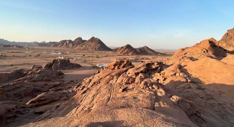
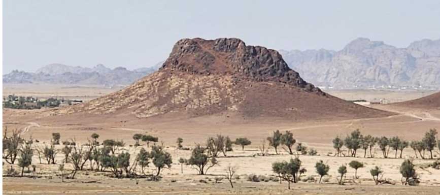
Jabal Al-Qataa is a mountain located in the Kingdom of Saudi Arabia. It is a prominent peak within the Sarawat mountain range, standing at an impressive 2,600 meters above sea level.

 
Abu Alda’a Natural Park

Aba Al-Daa’a Natural Park, located east of Al-Sabaan town, is a popular destination for families and visitors in the region.

 
Taba Heritage Village

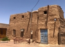
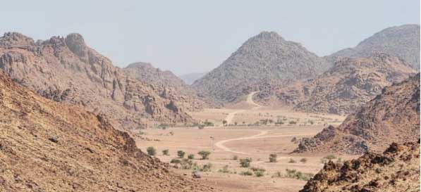
Taba stands as an exquisite archaeological village in a volcanic landscape 36 kilometers west of Faid Ancient Fortress. It is among the oldest settlements within the Hail region.

 
Harrat Hutaymah Crater

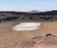
Situated at an altitude of 888 meters above sea level, this geographical feature goes by various names, including Al Hutaymah or Harrat Hutaymah. The term “harrat” is derived from Arabic and signifies a volcanic region.

 
Saud Al-Matwa’s Sons Farm

Lorem ipsum

 
Jad’a Valley

Lorem ipsum

 
Al-Arf Mountain

Lorem ipsum

 
Salma Mountain

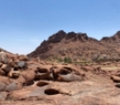
The summit of Salma Mountain is the peak of a mountain located in the Kingdom of Saudi Arabia. Salma Mountain is part of the Sarawat Mountain Range in the southwestern region of the country.

 
Ghar Laktan

Lorem ipsum

 
Black Crater

Lorem ipsum

 
Al-Shanan Garden

Al Shanan Garden offers a serene setting where you can unwind in the company of friends and family. You can find a diverse array of trees and plants at Al Shanan, creating an inviting atmosphere perfect for leisurely strolls and picnics

 
Camel Racing Field In Al-Shanan

Lorem ipsum

 
Ain Al-Abbas

Ain Al Abbas is a place of great historical and cultural significance, drawing researchers and history enthusiasts from around the world. It offers a unique opportunity to explore and learn about its rich historical heritage

 
Faid Museum

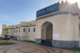
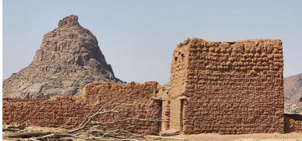
Before embarking on their archaeological journey, visitors can immerse themselves in the captivating exhibits of the Faid Museum. It’s a gateway to the rich history of the ancient fortress and its surroundings

 
Well Of Al-Khuwaimah

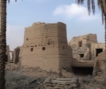
Al-Khuwaimah Well stands as a captivating archaeological gem within the Faid region, renowned for its exceptional beauty and historical significance.

 
Faid Reservoir – Darb Zubaidah

The Faid Reservoir is located in Darb Zubaidah (Zubaidah’s trail), the road linking the town of Kufa, Iraq, with Makkah. Stretching across 1,300km, this trail served as a historic pilgrimage route directly to the Holy city of Makkah.

Today

Salma Geopark Welcomes A Diverse Array Of Visitors, Ranging From Tourists, Nature Enthusiasts To Scientists And Archeologists.

For tour reservation

Learn More